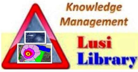
SERI LUSI LABORATORIUM ALAM,
UNGGULAN PENELITIAN MUD VOLCANO,
INDUK SEDIMEN SISTEM HIDROTERMAL BERHUBUNGAN GUNUNG MAGMATIK
Judul makalah terkait Lusi dihimpun atas kerjasama antara BPLS melalui Lusi Library:Knowledge Management dengan Humanitus Sidoarjo Fund (HSF) Austrlia 2010-2017
hardiprasetyolusi
Hardiprasetyolusi’s Blog
Prasetyo: Secara Imajiner Mengikuti Pertemuan EGU 2017
Prasetyo, LUSI 11 TAHUN, “Mengikuti Pertemuan EGU, April 2017 secara Imajiner” Dikontribusikan untuk Lusi Library:Knowledge Management.
Link: Prasetyo Secara Imajiner Mengikuti Pertemuan EGU 2017
Dikontribusikan untuk Lusi Library:Knowledge Management
Pertemuan Tahunan 2017, Persatuan Ilmu Kebumian Eropa Dilaksanakan di Kota Vienna, Austria April 2017
HIMPUNAN PRESENTASI LISAN DAN POSTER NASKAH DITERIMA DARI Co-Convener: DR. Matteo Lupi
BASELINE PAPER DIHIMPUN HSF AUSTRALIA DAN LUSI LIBRARY:KNOWLEDGE MANAGEMENT (BPLS) INDONESIA, 2006-2-14
| Title |
Author/Contributor |
| Corrigendum – Lusi mud eruption triggered by geometric focusing of seismic waves |
M. Lupi, E. H. Sanger, F. Fuchs, S. A. Miller Download |
| Supplementary Information – Corrigendum – Lusi mud eruption triggered by focusing of seismic waves |
M. Lupi, E. H. Sanger, F. Fuchs, S. A. Miller Download |
| Ground deformation associated with the eruption of Lumpur Sidoarjo |
Yosuke Aoki, Teguh Purnama Sidiq Download |
| Lusi mud eruption triggered by geometric focusing of seismic waves (copy from SciDev.Net website) |
M. Lupi, E. H. Sanger, F. Fuchs, S. A. Miller Download |
| Evolution and future of the Lusi mud eruption inferred from ground deformation |
M. L. Rudolph, M. Shirzaei, M. Manga, Y. Fukushima Download |
| A new hydrothermal scenario for the 2006 Lusi eruption. Insights from gas geochemistry |
Adriano Mazzini, Giuseppe Etipe, Henrik Svensen Download |
| Mud Volcano and its Evolution |
Bambang P. Istadi, Handoko T. Wibowo, Edy Sunardi, Soffian Hadi, Nurrochmat Sawolo Download |
| Frequency dependence of mud volcano response to earthquakes |
Maxwell L.Rudolph, Michael Manga Download |
| Social and Economic Impacts of the Sidoarjo Mudflow: Community Resettlement after Disaster |
Prasojo Bayu Sawondo Putro Download |
| A prediction of the longevity of the Lusi mud eruption, Indonesia |
Maxwell L. Rudolph, Leif Karlstrom, Michael Manga Download |
| After Four Years of Ground Displacements Following LUSI Mud Volcano Eruption: Sign of its Ending Eruption |
H. Andreas, H. Abidin, M. Kusama, I. Gumilar Download |
| Probabilistic longevity estimate for the LUSI mud volcano, East Java |
Richard J. Davies, Simon A. Mathias, Richard E. Swarbrick, Mark J. Tingay Download |
| Monitoring of LUSI Mud Volcano – a Geo-Pressured System, Java, Indonesia |
Manfred P. Hochstein, Sayogi Sudarman Download Download |
| Ground Displacements around LUSI Mud Volcano Indonesia as Inferred from GPS survey |
H. Andreas, Hasanuddin Z. Abidin, Mipi A. Kusuma, P. Sumintadireja, and I. Gumilar |
| Do you believe in coincidences? |
Adriano Mazzini Download |
| Fixing One Muddy Mess – Earth Magazine |
Erin Wayman Download |
| LUSI Research Report Summary |
Sergey V. Kadurin, Igor A. Losev, Lubov Y. Eremina, Maxim Belmesov, Igor K. Kadurin Download |
| LUSI Research Report Final |
Sergey V. Kadurin, Igor A. Losev, Lubov Y. Eremina, Maxim Belmesov, Igor K. Kadurin Download |
| Research Findings of Lumpur Sidoarjo |
Russian Institute of Geological Studies Download |
| Anatomy of the LUSI mud eruption, East Java |
Mark Tingay Download |
| Anatomy of the LUSI mud volcano, East Java |
Mark Tingay Download |
| Sawolo et al. (2009) the Lusi mud volcano controversy: Was it caused by drilling? |
Richard Davies, Michael Manga, Mark Tingay, Susila Lusianga, Richard Swarbrick Download |
| Was LUSI caused by drilling? Authors reply to discussion |
Nurrochmat Sawolo, Edi Sutriono, Bambang P. Istadi, Agung B. Darmoyo Download |
| Remote Monitoring of a Mud Volcano |
GEOconnexion International Download |
| Research Findings of Lumpur Sidoarjo – 3D Animation |
Russian Institute of Geological Studies View |
| Fluid transport properties and estimations of overpressure at the Lusi mud volcano, East Java Basin |
Wataru Tanikawa, Masumi Sekaguchi, Handoko Teguh Wibowo, Tashihiko Shimamoto, Osamu Tadai Download |
| Modelling Eruption Cycles and Decay of Mud Volcanoes |
Anna Zoporowski, Stephen A Miller Download |
| Modeling study of growth and potential geohazard of LUSI mud volcano |
Bambang P. Estadi., et al Download |
| Strike-slip faulting as a trigger mechanism for overpressure releases through piercement structures. Implications for the LUSI mud volcano |
Adriano Mazzini Download |
| Mud Volcanism : Processes and Implications |
Adriano Mazzini Download |
| East Java Mud Volcano (LUSI): Drilling Facts and Analysis |
Nurrochmat Sawolo, Edi Sutriono, Bambang P. Istadi, Agung B. Darmoyo Download |
| The Lusi Mud Eruption of East Java |
Mark Tingay, Oliver Heidbach, Richard Davies, Richard Swarbrick Download |
| Subsidence associated with the LUSI mud eruption, East Java, investigated by SAR interferometry |
Yo Fukushima, Jim Mori, Manabu Hashimoto, Yasuyuki Kano Download |
| Subsidence and uplift of Sidoarjo (East Java) due to the eruption of the LUSI mud volcano (2006 – present) |
H. Z. Abidin, R. J. Davies, M. A. Kusuma, H. Andreas, T. Deguchi Download |
| Mud Diapirs and Mud Volcanoes in depressions of Java to Madura : Origins, natures and implications to petroleum system |
Awang Harun Satyana and Asnidar Download |
| The East Java mud volcano (2006 to present): An earthquake or drilling trigger? |
Richard J. Davies, Maria Brumm, Michael Manga, Rudi Rubiandini, Richard Swarbrick, Mark Tingay Download |
| Mudflow Geology and Geophysics Studies in Porong, Sidoarjo, East Java |
IAGI (Indonesian Association of Geologists) Download |
| Mud Volcanoes – a review |
Maria Akesson Download |
| Triggering of the Lusi mud eruption – Earthquake versus drilling initiation |
Mark Tingay, Oliver Heidbach, Richard Davies, Richard Swarbrick Download |
| LUSI – Birth of a Mud Volcano – History and Impact |
Bambang Istadi Download |
| Regional earthquake as a trigger for enhanced volcanic activity: Evidence from MODIS thermal data |
Andrew J. L. Harris and Maurizio Ripepe Download |
| Birth of a mud volcano: East Java, 29 May 2006 |
Richard J. Davies, Richard E. Swarbrick, Robert J. Evans Download |
| The Science Behind The East Java Mud Flow (‘Lusi’) |
Mark Tingay Download |
| Triggering and dynamic evolution of the LUSI mud volcano, Indonesia |
A. Mazzini, H. Svensen, G.G. Akhmanov, G. Aloisi, S. Planke, A. Malthe-Sorenssen, B. Istadi Download |
| Muddy Waters – How did a mud volcano come to destroy an Indonesian town? |
Nature Publishing Download |
| Volcano gets choke chains to slow mud |
Nature Publishing Download |
| Bandarpanji – 1 Well Control Incident Report |
Download |
| Lapindo Brantas : Corporate Response and Human Needs |
Download |
| Review of Banjar Panji -1 Incident Planning and Execution of Drilling Program |
M. Dusseault and B. Singh Download |
| Bandar Panji – 1 Well Control Incident Report |
Ralph Adams Download |
| Mud Eruption Threatens Villagers in Java |
Science Magazine Download |
| Environmental Assessment – Hot Mud Flow |
United Nations Download |

KOLEKSI MAKALAH LUSI PADA JOURNAL MARINE PETROLEUM GEOLOGY (MPG) EDISI 2017
Makalah Ilmiah menempatkan Lusi sebagai laboratorium alam, Penelitian Induk-Sedimen Sistem Hidrotermal yang relatif baru lahir, berhubungan dengan gunung magmatik dan dihubungkan dengan Sistem Patahan Watukosek.
Merupakan kerjasama antara BPLS-LUSI LAB 2013-2017, akan dilanjutkan tahun 2018 antara PPLS-LUSI LAB.
Makalah Ilmiah lengkap dipublikasikan pada Jurnal Marine Petroleum Geology (MPG) Edisi Khusus 2017.
Makalah Ilmiah lainnya telah dipresentasikan secara lisan (oral) dan sesi poster, yaitu pada EGU 2017 di Austria
Makalah Ilmiah Lengkap (Full Paper)

Samankassou, E., Mazzini, A., Chiaradia, M., Spezzaferri, S., Moscariello, A., and do Couto, D., 2017,
Asal usul dan umur dari klastik karbonat dari semburan Lusi, Jawa, Indonesia
Ringkasah
- Penentuan umur dari klastik karbonat Lusi geysering dari situs semburan di Indonesia, dikombinasikan dengan interpretasi penampang seismik refleksi telah memungkinkan untuk membatasi kisaran umur dan untuk memperbaiki pemahaman terhadap sekuen satuan batugamping yang disimpulkan di situs ini.
- Implikasi dari hasilnya sangat beragam, termasuk fakta bahwa formasi Tuban dan Kujung yang saling tumpang susun di lokasi Lusi (that The Tuban and Kujung formations are overlapping at Lusi site).
- Saluran pengumpan Lusi telah terbreksikan (The Lusi feeder conduit brecciated) dan bergerak pada permukaan litologi karbonat (mobilized to the surface carbonate lithologies) yang terkubur pada kedalman yangmungkin mencapai 8 km (buried as deep as possibly ∼8 km).
- Sementara itu contoh-contoh karbonat lebih dalam (deeper carbonate samples) disemburkan tahun 2006 masuk pada tipe Formasi Kujung yang tidak overpressured, sebagai tambahan satuan-satuan overpressure yang dibangkitkan oleh satuan lebih dalam (Ngimbang Formation?) membutuhkan suatu daya agar fragmen ini mencapai permukaan,
Moscariello, A., Do Couto, D., Mondino, F., Booth, J., Lupi, M., and Mazzini, A., 2017,
Genesis dan Evolusi dari sistem Patahan Watukosek pada area Lusi, Jawa Timur
Outline
- Highlights
- Abstract
- Keywords
- 1. Introduction
- 2. Geographic and geological setting
- 3. Methods
- 4. Results
- 5. Interpretation and discussion
- 6. Conclusions
- Acknowledgments
- References
Ringkasan:
- Suatu pandangan baru pada bawah permukaan Lusi dan genesa dan evolusi dari suatu bentukan struktur kunci (evolution of a key structural feature) di kawassan ini.
- Pertama kalinya model struktur dan seismik stratigrafi (structural and seismo-stratigraphic model) dari kawaan disekitar Lusi.
- Pertama kalinya suati penafsian dan analisis atribut yang lengkap (The first complete interpretation and attribute analysis) dari penampang seismiik refleksi 2D dari industr yang telah ada (industry of existing industry 2D seismic lines).
- Fase genetik dari patahan Watukosek (The genetic phases of the Watuckosek fault) diawali dengan kelurusan tensi (started as tensional lineament) dan terlibat kedalam shear Riedel sinistral.
- Didukumentasikan suatu rotasi kebalikan arah jarum jam yang umum (Documented a general anticlockwise rotation) dari arah komresi utama (of the main compressional stress direction).
- Suatu model evolusi struktur yang baru (A new structural evolutionary model) menjelaskan terdapatnya antikline transpresif pada Pliosek Akhir/Pelistosen Bawah (explaining the presence of Late Pliocene/Lower Pleistocene transpressive anticlines).


Seismik straigrafi di bawah Lusi dan Porong-1


Di Felice, F., Mazzini, A., Romeo, G., and Di Stefano, G., 2017,
Drone mencitra resolusi tinggi Inframerah dari emburan lumpur Lusi
Drone high resolution infrared imaging of the Lusi mud eruption:
Ringkasan
- Mosaik citra-citra Infra merah (Infra red images mosaic) telah diambil pada suatu system semburan geysering klastis (was acquired over an erupting clastic geysering system).
- •Didiskusikan sebab-sebab adanya atenuasi dari spektur IR (Attenuation causes of the IR spectrum).
- •Dinamika konvektif (Convective dynamics) dari breksi lumpur yang mendidih (boiling mud breccia) ditafsirkan berlang pada bagian dalam kaldera (interpreted inside the caldera).
- •Pintu keluar dari migrasi fluida (Pathways for fluid migration) telah dapat dicitrakan berlangsung pada zona-zona patahan dan rekahan (imaged in faulted and fractured zones).
Gambar Utama
Inguaggiato, S., Mazzini, A., Vita, F., and Sciarra, A., 2017,
Komplek volkanik Arjuno-Welirang dan hubuganan denan system Lusi: Bukti-bukti dari geokimia
Ringkasan
- Geokimia fluida-fluida memperjelas suatu hubungan (Fluids geochemistry reveals a clear connection) antara semburan Lusi dan komplek Arjuno-Welirang yang berada didekatnya (between the Lusi eruption and the neighboring Welirang volcanic complex).
- Ada kesamaan ciri isotop helium magmatic (A similar magmatic helium isotopic signature) yang direkam dari fluida Lusi dan Welirang (is recorded for Lusi and Welirang fluids).
- Suatu kontribusi yang signifikan dari air andisitik (A significant contribution of andesitic water) yang dikenal pada uapair dari kawah gunung Welirang (is recognized in the water vapour of Welirang summit crater).
Sciarra, A., Mazzini, A., Inguaggiato, S., Vita, F., Lupi, A., and Hadi, S., 2017,
Anomali gas Radon dan Karbon sepanjang system patahan Watukosek dan semburan lumpur Lusi, Indonesia:
Ringkasah
- Gas dari tanah dan paparan CO2 dan CH4 (gas Soil gas and CO2 and CH4 fluxes) telah diukur sepanjang system Patahan Watukosek (were measured across the Watukosek Fault system).
- Tujuan utama adalah mendefinisikan terdapatnya dan geometri patahan dari data geokimis (Main goal is to define the presence and geometry of fault by geochemical data).
- Semua penampang memperlihatkan terdapatnya nilai gas yang tinggi pada perpotongan dengan zona-zona patahan (All profiles revealed higher gas values at the intersection with faulted zones).
- Baik gas-gas mikroba dangkal dan termogenik dalam (Both shallow microbial and deep sourced thermogenic gas) terdapat sepanjang patahan (coexist along the fault).

Mazzini, A., Scholz, F., Svensen, C., Hensen, C., and Hadi, S., 2017,
Geokimia dan asal usul dari air hidrotermal disemburkan pada Lusi, Indonesia

Ringkasan
- Air dari Kawah Lusi menunjukkan suatu anomali geokimia yang regional (Lusi crater waters represent a regional geochemical anomaly).
- Air-air yang disemburkan dihasilkan dari suatu percampuran yang komplek (the result of a complex mix) dari fluida sedimen dan hidrotermal (of sedimentary and hydrothermal fluids).
- Lusi bukan sebatai tipe gunung lumpur (Lusi is not a typical mud volcano) tapi suatu induk sedimen system hidrotrmal (but a sediment-hosted hydrothermal system).
- Komplek volkanik yang berdekatan telah mengunpan (The neighbouring volcanic complex feeds) fluida-fluida hidrotermal untuk semburan Lusi (hydrothermal fluids for the Lusi eruption).
Outline
-
- Highlights
- Abstract
- Keywords
- 1. Introduction
- 2. Geological setting
- 3. Methods
- 4. Results
- 4.1. Overall characteristics
- 4.2. Oxygen and hydrogen isotopes
- 4.3. Strontium isotopes
- 4.4. Time series
- 4.5. Iodine and bromine
- 5. Discussion
- 5.1. Clay mineral dehydration
- 5.2. Lusi water signature evolution: evaporation effect and meteoric fluids
- 5.3. Meteoric fluid-dominated localities
- 5.4. Interactions with carbonates, high temperature reactions, silicate minerals and organic matter
- 5.5. Insights and implications from strontium signatures
- 5.6. Summary and implications
- 6. Conclusions
- Acknowledgements
- References

Di Stefano, G., Romeo, G., Mazzini, A., Iarocci, A., Hadi, S., and Pelphrey, S., 2017
Drone Lusi: suatu alat bantu multidisiplin untuk mengakses lingkungan-lingkungan yang ekstrim:
Highlights
- Suatu drone yang serbaguna (A multipurpose drone) telah dirancang dan dibangun (has been designed and constructed) untuk dapat mengakses dan mengambil contoh-contoh dari lingkungan yang ekstrim (to access and sample extreme environments).
- Contoh-contoh Gas, air dan lumpur (Gas, water, and mud sampling) dipadukan dengan pengukuran pengukuran suhu (is coupled with temperature measurements), video records, fotografi (photogrammetry), infra merah (infra-red), dan pemetaan sebara gas (gas distribution mapping).
- Misi telah dapat dilakukan dengan sukses (Successful missions have been completed) pada lokasi semburan Lusi yang aktif (at the active Lusi eruption site).
- Drone merupakan alat bantu yang luar biasas (The drone is an excellent tool) untuk studi pada lokasi-lokasi yang ekstrim dan tidak dapat ditempuh (to study harsh or unreachable sites) dimana operasi yang konvensional akan sangat malah, bahaya dan tidak mungkin (where conventional operations are too expensive, dangerous or impossible).
Svensen, H., Iyer, K., Schmid, D., and Mazzini, A., 2017,
Pemodelan dari gas yang dibangkitkan mengikuti pemindahan dari suatu sill batuan beku dibawah Lusi, Jawa Timur, Indonesia
Modelling of gas generation following emplacement of an igneous sill below Lusi, east Java, Indonesia:
Ringkasan
- Telah diuji suatu hipotesis (We have tested a hypothesis) dimana suatu intrusi sill terdapat (where a sill intrusion is present) pada kedalaman di dekat Lusi.
- Telah dihitung pembangkitan CO2 (We have calculated the CO2 generation) mengikuti suatu penempatan dari suati sill berukuran 150m (following the emplacing a 150 m sill) pada sekuen sedimen yang kaya matrial organik pda kedalaman 4,5 km (in an organic rich sequence at 4.5 km).
- Skenario ini menyediakan CO2 yang saat ini diemisikan dari Lusi (This scenario may provide the CO2 currently emitted from Lusi), dan konsisten dengan informasi Geologi (are consistent with geological information).
Mauri, G., Husein, A., Mazzini, A., Karyono, K., Obermann, A., Bertrand, G. L., M., Prasetyo, H., Hadi, S., and Miller, S. A., 2017,
Konstrain perubahan densitas di dalam kaldera bentuk funnel dihasilkan dari pemantauan gayaberat dari semburan lumpur Lusi:
Ringkasan
- Pemantaunan gayaberat pada semburan lumpur yang sedang berlangsung (Gravity monitoring of ongoing mud eruption).
- Model 3D variasi gayaberat (3D model of gravity variations) untuk mendapatkan variasi gayaberat pada lumpur yang bergerak keatas (to constrain density variation in the rising mud).
- Penafsiran perbandingan gas dan lumpur (interpretation of gas, mud ratio) berdasarkan variasi densitas (based on density variation).
- Evolusi dari sinyal gayaberat terhadap waktu (Evolution of the gravity signal over time).
Mauri, G., Husein, A., Mazzini, A., Irawan, D., Sohrabi, R., Hadi, S., Prasetyo, H., and Miller, S. A., 2017,
Highlights
• Analisis variasi gayaberat pada area seluas 56 km persegi (Analyses of gravity variations over 56 square kilometers).
• Model 3D dari dua peningakatan gayaberat utama (3D model of 2 main gravity increases) di dalam tubuh lumpur (within the mud edifice).
•Penafsiran dari korelasi antara variasi-variasi gayaberat (Interpretation of correlation between gravity variations) dan ciri-ciri geologi (geological features).
•Evolusi dari struktur gayaberat dan tubuh lumpur antara 2006-2016 (Evolution of the gravity structures of the mud edifice between 2006 and 2016).
Miller, S. A., and Mazzini, A., 2017,
Lebih dari sepuluh tahun Lusi: Satu tinjauan dari fakta-fakta, kesatuan, studi masa lalu dan kedepan
Ringkasan
- Suatu tinjauan dari even-even yang berlangsung sejak inisiasi dari semburan Lusi tahun 2006 (Review of events since the initiation of the Lusi eruption in 2006).
- Identifikasi banyak ketidakjelasan pada argumen sebelumnya tentang inisiasi dari sistem ini (Identify numerous discrepancies in previous arguments about the initiation of this system).
- Suatu model konsepsi yang terdifinisikan secara baik (A well-constrained conceptual model) telah mengenal Lusi sebagai suatu sistem hidrotermal yang berhubungan dengan volkanik (recognizes Lusi as a volcanically linked hydrothermal system).
- Meninjuau penelitian yang sedang berlangsung dan studi ke depan (Highlight ongoing and future studies) untuk lebih memahami dinamika Lusi (to better understand the Lusi dynamics).
Tinjauan Makalah:
Semburan Lusi sepuluh tahun sebagai sistem gyser dengan sebagai periodik kuasi.
Semburan lumpur Lusi, terus berlangsung selama sepuluh tahun ini, dengan relatif tidak berhenti.
Saat ini kedudukan Semburan Lusi semakin mantap (its current steady-state), telah memperlihatkan suatu perilaku sebagai suatu sistem geyser dengan periodik kuasi (a quasi-periodic geyser system).
Banyak studi Lusi bertujuan untuk mengkuantitatifkan sistem semburan.
Banyak studi-studi pada masa lalu, sekarang, dan ke depan (Many past, current, and future studies) bertujuan untuk mengkuantitatifkan sistem ini (aim to quantify this system).
Lusi sistem hidrotermal baru dilahirkan dengan skala tektonik, berhubungan dengan komplek gunung api.
Semakin banyak bukti yang mendukung, bahwa Lusi merupakan suatu sistem hidrotermal yang baru dilahirkan dengan skala tektonik (a new-born, tectonic scale hydrothermal system).
Berhubungan dengan komplek gunung api yang berlokasi di dekatnya (linked to the nearby volcano complex).
Perdebatan masih berlanjut apakah Lusi dipicu sebagai peristiwa alam atau oleh pemboran.
Perdebatan masih terus berlanjut tentang apakah pemicu Lusi (The debate about whether the triggering of Lusi) sebagai peristiwa alami (was a natural event) di satu sisi.
Atau disisi lain, lebih disebabkan oleh pengeboran (of rather caused by drilling continues).
Bukti yang ada dari perilaku sistim Lusi, tidak mungkin dipicu oleh antropogenik.
Tapi bukti-bukti yang ada dari perilaku sistem ini (but evidence mounts from the behavior of this system), telah menunjukkan.
Bahwa penyebab antropogenik sangat tidak mungkin (anthropogenic cause is highly unlikely).
Alasan pentingnya memahami sistem ini karena telah menimbulkan dampak sosial yang luar biasa.
Memahami sistem ini sangat penting (understanding this system is very important).
Karena dampak sosial dan ekonomi pada masyarakat si sekitarnya (because of its social and economic impact on the surrounding communities).
Pertanyaan penting adalah apakah ke depan semburan Lusi masih dapat menimbulkan bencana geologi susulan?
Pertanyaan penting adalah apakah semburan Lusi masih dapat menimbulkan geohazard (whether it poses future geohazards).
Pada wilayah yang sekarang ini, dari suatu semburan yang bias terjadi di masa depan (in the region from future eruptions).
Saat ini di dalam daerah luapan lumpur terus dilakukan upaya besar dengan infrastruktur tangggul dan aktivitas pemeliharaan berlanjut.
Sebuah upaya besar dari infrastruktur dan aktivitas pemeliharaan yang berlanjut telah dan sedang dilakukan, di dalam daerah luapan lumpur seluas 7km2 (umum disebut Peta Area Terdampak disingkat PAT).
Wilayah ini dikelilingi oleh tanggul yang tinggi (this region is framed by a tall embankment), di dalamnya berisi lumpur yang telah disemburkan (that contains the erupted mud) dari Kawah Lusi.
Ditujukan untuk melindungi pemukiman sekitarnya (and protects the surrounding settlements).
Sistem semburan Lusi penting memahami sistem dengan sekala lebih besar dari suatu hidrotermal volkanik.
Sistem ini juga sangat penting (This system is also very important) bagi pemahaman pada skala yang lebih besar lagi (for understanding at a larger scale). Yaitu sistem hidrotermal volkanik (volcanic hydrothermal system).
Disamping itu juga untuk menentukan, apakah sumber daya panas bumi yang baru ini (to determine whether this new geothermal resource), mungkin bisa dimanfaatkan (might be exploited).
Upaya besar sedang dilakukan untuk mempelajari sistem Lusi dari perspektif geokimia, geofisika dan pemodelan.
Upaya besar sedang berlangsung dari hibah-Uni Eropa untuk mendukung proyek Lusi-Lab (Ceed, Universitas Oslo) dan hibah SNF mendukung Universitas Neuchatel.
Untuk mempelajari sistem ini (to study this system) dari perspektif geokimia, geofisika, dan pemodelan (from geochemical, geophysical, and modeling perspectives).
Ringkasan merangkum apa yang diketahui apa yang masih belum jelas, termasuk mencermati perilaku Lusi.
Ulasan pembicaraan ini merangkum apa yang diketahui (what is known), apa yang masih belum jelas (what is still unclear).
Juga akan kembali mencermati perilaku Lusi (will revisit the behavior of Lusi) sejak awal (since its inception).
Collignon, M., Schmid, D. W., Galerne, C., Lupi, M., and Mazzini, A., 2017,
Pemodelan aliran fluida paa semburan klastik: Aplikasi untuk semburan lumpur Lusi
Ringkasan
- Metoda analitik dan numerik telah diterapkan (Analytical and numerical methods are employed) untuk menyelidikasi aliran fluida (to investigate fluid flow) pada mud volcano aktif (in active mud volcanoes) atau induk-sedimen sistem hidrotrmal (ISSH) atau (sediment-hosted hydrothermal syste – SHHS).
- Dipresentasikan pengaruh radius saluran (The effects of conduit radius) dan sifat-sifat pada kecepatan fluida (fluid properties on the flow rate).
- Radius saluran dari sistem pembubungan (Conduit radius of such piercement systems) tidak dapat melebihi dari kedalaman beberapa meter (cannot exceed a few metres at depth).
- Klastik bila tidak dalam paket yang padat, tidak memberikan pengaruh pada kecepatan aliran, bila ukurannya lebih kecil dari satu per lima dari saluran (Clasts, if not densely packed), will not affect the flow rate when they are smaller than a fifth of the conduit size).
- Suatu eksolusi maksimal antara kedalaman 1800m dan 3200m (A maximal exsolution depth between 1800 and 3200 m) di perkirakan untuk CH4 (is inferred for CH4) dan antara 750 dan 1000m untuk CO2 (between 750 and 1000 m for CO)2.
Sohrabi, R., Jansen, G., Malvoisin, B., Mazzini, A., and Miller, S. A., 2017,
Pemodeal numerik dari sistem hidrotermal Lusi: Hasil awal dan tantangan ke depan
Ringkasan
- Suatu model geologi (A geological model) berdasarkan pengintegrasian data dari penelitian sebelumnya (based on data gathered from previous studies) sebelum inisiasi semburan Lusi (prior to the initial Lusi eruption).
- Suatu grid numerik yang dibangkitkan (A numerical grid using our mesh generator) menyediakan suatu domain numerik (that provides a numerical domain).
- Suatu model termodinamika dari solubitas CO2 (CO2 A thermodynamic model dalam CO2 solubititas dalam solusi air NaCl (of CO2solubility in aqueous NaCl solution), ditunjukkan dari sistem Lusi (representative of the Lusi system).
- Suatu istem dua fase antara air/CO2 (A two-phase system (Water/CO2)) dipadukan dengan suat model mekanik yang sederhana (coupled to a simplified model of mechanics).

Panzera, F., D’Amico, S., Lupi, M., Mauri, G., Karyono, K., and Mazzini, A., 2017,
Sturkur hidrotermal Lusi dihasilkan dari pengukuran vibrasi ambien
Ringkasan
- Pada studi ini telah digunakan metoda HVSR (In this study, we applied the HVSR method) untuk mendapatkan struktur nah di bawah permukaan pada komplek Lusi (to infer the subsoil structure at Lusi complex).
- Ditafsirkan hasil-hasil yang terkait dengan kontras pada kecepatan litologi (interpret the results as related to the velocity lithological contrast) pada kedalaman antara endapan alluvial dan lempung (at depth between alluvial deposits and clay).
- Di presentasikan perbedaan hasil dari HVSR (present comparison of the HVSR results) dengan data dihimpun di area (gayaberat with gravimetry data collected in the area).
Obermann, A., Karyono, K., Diehl, T., Lupi, A., and Mazzini, A., 2017,
Seismisitas di Lusi dan skitar komplek volkanik, Jawa, Indonesia
Ringkasan
- Kecepatan yang rendah dari aktivitas mikro-seismik (Low rate of micro-seismic activity) merupakan klaster di bawah komplek volkanik Arjuno-Welirang pada kerak bagian atas (that clusters below the Arjuno-Welirang volcanic complex in the upper crust).
- Rezim tektonik patahan geser sinistral (Tectonic regime of sinistral strike-slip faulting).
- Deformasi permukaan pada Lusi (Surface deformations at Lusi) tampaknya karena deformasi aseismik (likely due to aseismic deformation) daripada proses-proses brittle rupture.

EGU 2017:
Makalah Ilmiah menempatkan Lusi sebagai laboratorium alam, Penelitian Induk-Sedimen Sistem Hidrotermal yang relatif baru lahir, berhubungan dengan gunung magmatik dan dihubungkan dengan Sistem Patahan Watukosek.
Merupakan kerjasama antara BPLS-LUSI LAB 2013-2017, akan dilanjutkan tahun 2018 antara PPLS-LUSI LAB.
Makalah Ilmiah lengkap dipublikasikan pada Jurnal Marine Petroleum Geology (MPG) Edisi Khusus 2017.

| GMPV1.4/BG9.68/SSP3.15
Dari sistem hidrotermal ke struktur mud volcano: struktur, evolusi dan pemantauan pembubungan aktif dan purba
From hydrothermal systems to mud volcanoes: structure, evolution and monitoring of active and fossil piercements (co-organized)
|
Convener: Adriano Mazzini
Co-Convener: Matteo LupiPosters GMPV1.4/BG9.68/SSP3.15
GMPV1.4/BG9.68/SSP3.15
Dari sistem hidrotermal ke mud volcano: struktur, evolusi dan pemantauan pembubungan yang aktif dan purba
From hydrothermal systems to mud volcanoes: structure, evolution and monitoring of active and fossile piercements (co-organized)
|
Convener: Adriano Mazzini
Co-Convener: Matteo Lupi
Hubungan dinamika semburan Lusi dengan aktivitas seismic global dan regional: Analissis statistik
Linking the Lusi mud eruption dynamics with regional and global seismic activity: a statistical analysis.
Marine Collignon, Øyvind Hammer, Mohammad J. Fallahi, Matteo Lupi, Daniel W. Schmid, Husein Alwi, Soffian Hadi, and Adriano Mazzini
Geophysical Research Abstracts Vol. 19, EGU2017-4822, 2017 EGU General Assembly 2017 © Author(s) 2017. CC Attribution 3.0 License.
Marine Collignon (1), Øyvind Hammer (2), Mohammad J. Fallahi (1), Matteo Lupi (3), Daniel W. Schmid (4), Husein Alwi (1,5), Soffian Hadi (6), and Adriano Mazzini (1) (1) University of Oslo, Centre for Earth Evolution and Dynamics (CEED), Oslo, Norway (marine.collignon@geo.uio.no), (2) Natural History Museum, University of Oslo, (3) Department of Earth Science, Geneva, Switzerland, (4) Physics of Geological Processes (PGP), Department of Geosciences, University of Oslo, (5) Institut Teknologi Sepuluh Nopember, Surabaya, Indonesia, (6) Badan Penanggulangan Lumpur Sidoarjo, Sidoarjo,
Indonesia The 29th May 2006, gas water and mud breccia started to erupt at several localities along the Watukosek fault system in the Sidoarjo Regency in East Java Indonesia.
The most prominent eruption site, named Lusi, is still active and the emitted material now covers a surface of nearly 7 km2, resulting in the displacement of ∼ 60.000 people (up to date).
Due to its social and economic impacts, as well as its spectacular dimensions, the Lusi eruption still attracts the attention of international media and scientists.
In the framework of the Lusi Lab project (ERC grant nº 308126), many efforts were made to develop a quasi-constant monitoring of the site and the regional areas.
Several studies attempted to predict the flow rate evolution or ground deformation, resulting in either overestimating or underestimating the longevity of the eruption.
Models have failed because Lusi is not a mud volcano but a sedimentary hosted hydrothermal system that became apparent after the M6.3 Yogyakarta earthquake.
Another reason is because such models usually assume that the flow will decrease pacing the overpressure reduction during the deflation of the chamber.
These models typically consider a closed system with a unique chamber that is not being recharged. Overall the flow rate has decreased over the past ten years, although it has been largely fluctuating with monthly periods of higher mud breccia discharge.
Monitoring of the eruption has revealed that numerous anomalous events are temporally linked to punctual events such as earthquakes or volcanic eruptions. Nevertheless, the quantification of these events has never been investigated in details. In this study, we present a compilation of anomalous events observed at the Lusi site during the last 10 years.
Using Monte Carlo simulations, we then statistically compare the displacement, recorded at different seismic stations around Lusi, with the regional and global earthquakes catalogue to test the probability that an earthquake striking the coast of Java affects the plumbing system at Lusi and triggers anomalous events
Penyelidikan geofisikan dan geokimia dari mud volcano Kalang-Anyar Indonesia:
Alwi Husein, Adriano Mazzini, Matteo Lupi, Alessandra Sciarra, and Karyono Karyono
Geophysical Research Abstracts Vol. 19, EGU2017-7160, 2017 EGU General Assembly 2017 © Author(s) 2017. CC Attribution 3.0 License.
Alwi Husein (1,2,3), Adriano Mazzini (1), Matteo Lupi (4), Alessandra Sciarra (5), and Karyono Karyono (6) (1) Centre for Earth Evolution and Dynamic (CEED), University of Oslo, Oslo, Norway (alwihusein86@gmail.com), (2) Institut Teknologi Sepuluh November, Surabaya, Indonesia, (3) BPLS, Surabaya, Indonesia, (4) Earth and Environmental Science, University of Geneva, Geneva, Switzerland, (5) Istituto Nazionale di Geofisica e Vulcanologia, Rome, Italy, (6) Padjajaran University (UNPAD), Bandung, Indonesia
The northest Java region is a sedimentary basin as well as a promising hydrocarbon province. Like other similar setting, the region is characterized by diffused mud volcanism and degassing sites.
In the Sidoarjo province extends the Watukosek Fault system that connects the Javanese Arjuno-Welirang Volcanic arc to the back-arc basin in North East Java. Along this fault systems can be identified several mud volcanoes including the spectacular Lusi mud eruption site.
Approximately 40 km NE of Lusi is located the Kalang Anyar mud volcano that was target for a multidisciplinary study to understand its activity as well as the plumbing system.
We combined geoelectrical, gas sampling and mapping studies and seismic monitoring. The geoelectrical data show low resistivity values (< 1 ohm.m) in the regions surrounding the mud vents until 120 m deep.
Profile 1 covers the most part of the mud volcanic edifice and points out that the region of low resistivity around the vents reaches a maximum width of approximately 250 m.
Overall, the three profiles held consistent results. The gas were sampled from the main vent revealing the presence of mixed as well as thermogenic methane suggesting that the more active seeps are deep rooted and connect to thermogenic methane reservoirs.
CH4 and CO2 flux profiles were conducted through the active crater area and extending towards the outskirts. Results shows anomalous high values of the gasses in the summit region revealing a methane dominated diffused degassing throughout the structure.
The seismic data show a drumbeat signal in the high-frequency range (i.e. between 5 Hz and 30 Hz) occurring on all the seismic stations.
The signal is most pronounced on the seismic station closer to the most active emission vent. Such seismic signal is seen at regular intervals varying from about 40 s to 120 s
|
|
Penyelidikan sistem patahan Watukosek menggunakan kombinasi metoda geofisika disekitar lokasi semburan Lusi
Alwi Husein, Adriano Mazzini, Matteo Lupi, Guillaume Mauri, Andreas Kemna, Bagus Santosa, and Soffian Hadi
Alwi Husein (1,2,3), Adriano Mazzini (1), Matteo Lupi (4), Guillaume Mauri (5), Andreas Kemna (6), Bagus Santosa (2), and Soffian Hadi (3) (1) CEED, University of Oslo, Oslo, Norway(alwihusein86@gmail.com), (2) Institut Teknologi Sepuluh November, Surabaya, Indonesia, (3) BPLS, Surabaya, Indonesia, (4) Earth and Environmental Science, University of Geneva, Geneva, Switzerland, (5) University of Neuchâtel, Switzerland, (6) University of Bonn, Germany
The Lusi mud eruption is located in the Sidoarjo area, Indonesia and is continuously erupting hot mud since its birth in May 2006.
Lusi sits upon the Watukosek fault system that originates from the neighboring ArjunoWelirang volcanic complex and develops in back-arc basin extending towards the NE of Java. After the 27-06-2006 M 6.3 earthquake this fault system was reactivated and hosted numerous hot mud eruptions in the Sidoarjo area.
Until now, no targeted investigations have been conducted to understand the geometry of the faults system crossing the Lusi eruption site. A comprehensive combined electrical resistivity and self-potential (SP) survey was performed in the 7 km2 area inside the Lusi embankment that was built to contain the erupted mud and to prevent flooding of the surrounding roads and settlements.
Additional profiles were also acquired outside the SW part of the embankment towards the Watukosek escarpment and on the west of Lusi. The goal of the geophysical survey is to map the near-surface occurrence of the Watukosek fault system, delineate its spatial pattern, and monitor its development.
In total nine lines of resistivity measurements using Wenner and Wenner-Schlumberger configuration and SP measurements using roll-along technique were completed.
The resistivity data were inverted into 2-D resistivity images with a maximum penetration depth of almost 200 m. The profiles collected in the region inside the Lusi embankment consistently reveal the presence of a region of ∼300 m in width (between 30-90 m depth) characterized by anomalous resistivities, which are lower than the values observed in the surrounding area.
The profiles outside the embankment show consistent results. Here the contrast between anomalous low resistivity zones (perceived as the fault system) and the surrounding area with higher resistivity value is more pronounced.
The profiles also shows that the distance between the main crater and the boundary of mud body observed on the subsurface reach ∼1.3 km. The results of the SP data fit well with the resistivity profiles in the anomalous parts, which suggests that their origin is related to fluid flow in the subsurface.
The geometry and the orientation these defined zones are consistent with the direction of the Watukosek fault system that intersect the Lusi eruption site and continues towards the Madura straight where other piercements are located.
Dinamika semburan Lusi: Konstrain dari data lapangan
Adriano Mazzini, Alessandra Sciarra, Matteo Lupi, Guillaume Mauri, Karyono Karyono, Alwi Husein, Ida Aquino, Ciro Ricco, Anne Obermann, and Soffian Hadi
Geophysical Research Abstracts Vol. 19, EGU2017-16046, 2017 EGU General Assembly 2017 © Author(s) 2017.
Adriano Mazzini (1), Alessandra Sciarra (2), Matteo Lupi (3), Guillaume Mauri (4), Karyono Karyono (1), Alwi Husein (1), Ida Aquino (2), Ciro Ricco (2), Anne Obermann (5), and Soffian Hadi (6) (1) CEED – University of Oslo, CEED, Oslo, Norway (adriano.mazzini@geo.uio.no), (2) INGV, Italy, (3) Département des Sciences de la Terre, Geneva, Switzerland, (4) University of Neuchâtel, Switzerland, (5) ETH Zurich, Switzerland, (6) BPLS, Sidoarjo, Indonesia
The Indonesian Lusi eruption has been spewing boiling water, gas, and sediments since the 29th of May 2006. Initially, numerous aligned eruptions sites appeared along the Watukosek fault system that was reactivated after the Yogyakarta earthquake occurring the 27th of May in the Java Island.
Since its birth Lusi erupted with a pulsating behavior showing intermittent periods of stronger activity resulting in higher fluids and solid emissions intervals. Since 2010 two active vents are constantly active.
We conducted detailed monitoring of such clastic geysering activity and this allowed us to distinguish four distinct phases that follow each other and that reoccur every ∼30 minutes:
(1) regular bubbling activity (constant emission of water, mud breccia, and gas); (2) clastic geysering phase with intense bubbling (consisting in reduced vapor emission and more powerful diffused mud bursting); (3) clastic geysering with mud bursts and intense vapour discharge (typically dense plume that propagates up to 100 m in height); (4) quiescent phase marking the end of the geysering activity (basically no gas emissions or bursts observed).
In order to better understand this pulsating behavior and to constrain the mechanisms controlling its activity, we designed a multidisciplinary monitoring of the eruption site combining the deployment of numerous instruments around the crater site.
Processing of the collected data reveals the dynamic activity of Lusi’s craters. Satellite images show that the location of these vents migrated along a NE-SW direction.
This is subparallel to the direction of the Watukosek fault system that is the zone of (left) lateral deformation upon which Lusi developed in 2006.
Coupling HR camera images with broadband and short period seismic stations allowed us to describe the seismic signal generated by clastic geysering and to constrain the depth of the source generating the signal.
We measure a delay between the seismic (harmonic) record and the associated clastic geyser explosion of approximately 3 s. This, in agreement with previous studies, corresponds to a source located some tens of meters depth inside the conduits.
We ascribe the harmonic seismic signal to rise of batches of H2O-CO2-CH4 fluids inside the conduit. Once they approach the water-vapour region the sudden pressure drop triggers flashing and the exsolution of the dissolved CO2 and CH4.
In the last part of our study we verified whether the powerful clastic geysering (emitting jets up to 20 m high) may induce local deformation of the mud edifice.
During the stronger geysering events we measure an increase and drop of gravity overtime that are related to change of mud density within the feeder conduit.
We process continuous camera recordings with a video magnifying tool capable of enhancing small variations in the recorded images. Results highlight that major eruptive events are preceded by a deformation of the mud edifice surrounding the vents.
Ongoing studies aim to verify if these events are also captured by the tiltmeter measurements.
This study represents a step forward to better understand the activity that characterizes Lusi. Further studies will help to better constrain the reactions and dynamics ongoing inside the conduit
|
Martin Krueger, Adriano Mazzini, Georg Scheeder, and Martin Blumenberg
Geophysical Research Abstracts Vol. 19, EGU2017-6423-1, 2017 EGU General Assembly 2017 © Author(s) 2017. CC Attribution 3.0 License.
Martin Krueger (1), Adriano Mazzini (2), Georg Scheeder (1), and Martin Blumenberg (1) (1) BGR, Resource Geochemistry, Hannover, Germany (martin.krueger@bgr.de), (2) Centre for Earth Evolution and Dynamics (CEED) University of Oslo, Oslo, Norway
The Lusi eruption represents one of the largest ongoing sedimentary hosted geothermal systems, which started in 2006 following an earthquake on Java Island.
Since then it has been continuously producing hot and hydrocarbon rich mud from a central crater with peaks reaching 180.000 m3 per day.
Numerous investigations focused on the study of microbial communities which thrive at offshore methane and oil seeps and mud volcanoes, however very little has been done on onshore seeping structures.
Lusi represents a unique opportunity to complete a comprehensive study of onshore microbial communities fed by the seepage of CH4 as well as of liquid hydrocarbons originating from one or more km below the surface.
While the source of the methane at Lusi is unambiuous, the origin of the seeping oil is still discussed. Both, source and maturity estimates from biomarkers, are in favor of a type II/III organic matter source.
Likely the oils were formed from the studied black shales (deeper Ngimbang Fm.) which contained a Type III component in the Type II predominated organic matter.
In all samples large numbers of active microorganisms were present. Rates for aerobic methane oxidation were high, as was the potential of the microbial communities to degrade different hydrocarbons.
The data suggests a transition of microbial populations from an anaerobic, hydrocarbon-driven metabolism in fresher samples from center or from small seeps to more generalistic, aerobic microbial communities in older, more consolidated sediments.
Ongoing microbial activity in crater sediment samples under high temperatures (80-95C) indicate a deep origin of the involved microorganisms.
First results of molecular analyses of the microbial community compositions confirm the above findings.
This study represents an initial step to better understand onshore seepage systems and provides an ideal analogue for comparison with the better investigated offshore structures.
|
|
Endapan karbonat dibawah semburan Geysering Lusi, Jawa, Indonesia
Elias Samankassou, Adriano Mazzini, Massimo Chiaradia, and Silvia Spezzaferri
Geophysical Research Abstracts Vol. 19, EGU2017-16035, 2017 EGU General Assembly 2017 © Author(s) 2017. CC Attribution 3.0 License.
Elias Samankassou (1), Adriano Mazzini (2), Massimo Chiaradia (1), and Silvia Spezzaferri (3) (1) University of Geneva, Department of Earth Sciences, Geneva, Switzerland (elias.samankassou@unige.ch), (2) University of Oslo, Centre for Earth Evolution and Dynamics, Oslo, Norway, (3) University of Fribourg, Department of Geosciences, Fribourg, Switzerland
The eruption site in East Java nicknamed Lusi is an active sedimentary hosted hydrothermal system that has been active since the 29th of May 2006.
The sedimentary sequences pierced by the Lusi feeder channel are brecciated and expelled at the surface as mud breccia mixed with boiling fluids.
The depth of the conduit remains so far unknown as well as the age of some of the inferred stratigraphic sequences. Over the years we documented and collected a large set of erupted clast specimens since the initiation of the eruption.
Here we describe the results of foraminifera and 87Sr/86Sr dating of selected scleractinian coral fragments and carbonate clasts rich in planktonic foraminifera collected around the eruption crater site.
The clasts were collected in 2006 during the early eruptive phases of Lusi. The aim of this work is to constrain the age of the components and to improve the understanding of the, so far unknown, sequence of carbonate deposits inferred in this region of Java.
Kujung and Tuban are the two formations consisting of carbonates known from this region. Based on planktonic foraminifera biostratigraphy, one group of the samples reveal to belong to the Planktonic Foraminifera Zone M5, with an age comprised between 16.29 and 15.10 Ma (Miocene, Latest Burdighalian to Langhian).
The Sr isotope-based ages of clasts analysed for 87Sr/86Sr cover a larger time window spanning from Pliocene (Zanclean and Piacenzian), Miocene (Messinian) down to Oligocene (Chatian).
The Pliocene and Messinian ages are unreasonably young from what is known of the local geology and one sample provided an 87Sr/86Sr age that is ∼8 My younger compared to that obtained from the planktonic foraminifera assemblage occurring in that sample.
This suggests that this and the young samples have been contaminated by geological sediments with higher radiogenic Sr isotope composition.
Therefore these samples may be ascribed to the Miocene Tuban Formation. The minimum age of 23.77 Ma obtained by 87Sr/86Sr indicates that some of the clasts can be attributed to the Upper Kujung Formation.
This dating method is an efficient tool to investigate the geometry of the eruption system and the implications of the results are multiple including the fact that :
a) the two Tuban and Kujung formations are overlapping at this site;
b) the Lusi feeder conduit brecciated and mobilized to the surface lithologies buried as deep as possibly 3.4 km;
c) since the deeper samples erupted in 2006 belong to the typically not overpressured Kujung Formation, an additional overpressure generated from deeper units (Ngimbang Fm?) would be required to force these fragments to surface.
|
| EGU2017-12614
Pandangan terhadap struktur and aktivitas tubuh Lumpur Lusi dari pemantauan gayabera di daratan
Insights on the structure and activity of Lusi mud edifice from land gravity monitoring.
Guillaume Mauri, Alwi Husein, Karyono Karyono, Soffian Hadi, Hardi Prasetyo, Matteo Lupi, Anne Obermann, Adriano Mazzini, and Stephen A. MillerGeophysical Research Abstracts Vol. 19, EGU2017-12614, 2017 EGU General Assembly 2017 © Authors 2017.
Guillaume Mauri (1), Alwi Husein (2,3,4), Karyono Karyono (2,5,6), Soffian Hadi (4), Hardi Prasetyo (4), Matteo Lupi (7), Anne Obermann (8), Adriano Mazzini (2), and Stephen A. Miller (1) (1) University of Neuchâtel, Center for Hydrogeology and Geothermics, CHYN, Neuchâtel, Switzerland (guillaume.mauri@unine.ch), (2) CEED, University of Oslo, Oslo, Norway, (3) Institut Teknologi Sepuluh Nopember, Surabaya, Indonesia, (4) Badan Penanggulangan Lumpur Sidoarjo, Sidoarjo, Indonesia, (5) Padjadjaran University (UNPAD), Bandung, Indonesia, (6) Agency for Meteorology, Climatology and Geophysics (BMKG), Jakarta, Indonesia, (7) Department of Earth Sciences, Université de Genève, Genève, Switzerland, (8) Swiss Seismological Service, ETH Zurich, Switzerland
The Lusi mud eruption in East Java, Indonesia, active since May 2006, is a sedimentary-hosted hydrothermal system (SHHS) fed by magmatic fluids connected to the Arjuno-Welirang volcanic complex.
The aims of the present study are to investigate changes in the local gravity field to obtain new insight into:
1) the evolution of the collapse structure ten years after its inception,
2) provide new insights on the thickening of the mud edifice for constraints on 3D numerical models, and
3) the pulsating phases characterizing the Lusi activity,
which result in temporal density variations of the mudflow inside the active conduit.
To investigate the structure of the mud edifice, we conducted a gravity spatial mapping over an area of 56 km2 with 390 new gravity stations. To investigate the density changes happening over time, we conducted several continuous gravity monitoring.
We present results from gravity measurement collected during field campaigns in June and August 2016, and augmented by passive seismic and environmental parameter monitoring.
We calculated for a reference density of 2,670 kg m-3 a new Bouguer anomaly map, which shows significant changes in the local gravity field in comparison to the previously published 2006-gravity map. In the west and south part of the edifice, maximum gravity decreases (-1 mGal) characterize the collapse of part of the edifice.
In the southeast and east of the central area of flooded mud breccia, the gravity field increases locally (+1 mGal) along the limit defined by a previous study on the surface deformation of the mud edifice.
The 3D model supports the hypothesis of a locally pinched volume of either mud, sediment, or mix of both between the subsiding volume and the uplifting volume of mud.
The continuous gravity monitoring experiments were located at 320 and 380m away from the central area of a mud breccia flooded region. Over time, residual gravity variations reach up to 0.020 mGal in amplitude and occur at wavelengths ranging from 8.2 hours to 45.1 hours. Some very short gravity variation events, with durations of less than one hour, correlate with rapid change of atmospheric temperature and pressure, or stream temperature.
Gravity variations over time cross-correlate well with the duration increase of seismic events. In addition, from our 3D forward model, within the conduit feeding each active vent, the mud density variations range between 100 and 775 kg m-3.
Even at distances of 320 to 460m from the eruptive vents, this study shows that gravity monitoring and atmospheric pressure monitoring are potentially valuable tools for monitoring and gaining insight into processes occurring in the feeder conduit of a mud eruption.
We show that gravity method is an efficient method to monitor the evolution of an active mud edifice by bringing new insight on the mud edifice structures, and over time on the density change, which is associated to changes in the eruption dynamics.
|
|
Survei mikrotremor untuk mendefinisikan struktur di bawah tanah dari area mud volcano
A microtremor survey to define the subsoil structure in a mud volcano areas
Francesco Panzera, Sebastiano D’Amico, Matteo Lupi, Karyono Karyono, and Adriano Mazzini
Geophysical Research Abstracts Vol. 19, EGU2017-17666, 2017 EGU General Assembly 201 © Author(s) 2017.
Francesco Panzera (1), Sebastiano D’Amico (2), Matteo Lupi (3), Karyono Karyono (4), and Adriano Mazzini (4) (1) Department of Biological, Geological and Env. Sciences, University of Catania, Italy , (2) Department of Geosciences, University of Malta, Malta, (3) Department of Earth Sciences, University of Geneva, Geneva, Switzerland, (4) Centre for Evolution and Earth Dynamics, University of Oslo, Oslo, Norway
Mud erupting systems have been observed and studied in different localities on the planet. They are characterized by emissions of fluids and fragmented sedimentary rocks creating large structures with different morphologies.
This is mainly due to the presence of clay-bearing strata that can be buoyant in the surrounding regions and overpressured fluids that facilitate the formation of diapirs through sedimentary rocks.
In this study, we investigate the Lusi mud erupting system mainly by using ambient vibration methods. In particular, thickness of the sediments and the body wave velocities have been investigated.
Results are integrated with gravimetry and electrical resistivity data in order to locate the main geological discontinuities in the area as well as to reconstruct a 3D model of the buried structure.
The approach commonly used for this type of studies is based on the ratio of the horizontal to vertical components of ground motion (HVSR) and on passive array techniques. The HVSR generally enables to recognize peaks that point out to the fundamental frequency of the site, which usually fit quite well the theoretical resonance curves. The combination of HVSR and shear wave velocity, coming from passive array techniques, enables to collect valuable information about the subsurface structures.
Here we present new data collected at the mud volcano and sedimentary hosted hydrothermal system sites in order to investigate the depths of the main discontinuities and of the hypothesized hydrocarbon reservoirs.
We present the case study of Salse di Nirano (northen Italy), Salinelle (Mt. Etna, Sicily) and Lusi hydrothermal systems (Indonesia).
Our results indicate that the ambient vibrations study approach represents a swift and simplified methods that provides quick information on the shallow subsoil structure of the investigated areas.
Kegempaan di Lusi dan sekitar komplek volkanik, Jawa, Indonesia
Anne Obermann, Karyono Karyono, Tobias Diehl, Matteo Lupi, and Adriano Mazzini
Geophysical Research Abstracts Vol. 19, EGU2017-14286-1, 2017 EGU General Assembly 2017 © Author(s) 2017. CC Attribution 3.0 License.
Anne Obermann (1), Karyono Karyono (2,3), Tobias Diehl (1), Matteo Lupi (4), and Adriano Mazzini (5) (1) ETH, SED, Zürich, Switzerland (anne.obermann@sed.ethz.ch), (2) Padjadjaran University (UNPAD), Bandung, Indonesia, (3) Agency for Meteorology, Climatology and Geophysics (BMKG), Jakarta, Indonesia, (4) Department of Earth Sciences, University of Geneva, Switzerland, (5) CEED, University of Oslo, Oslo, Norway
We study the local seismicity around the spectacular Lusi eruption site, a sedimentary-hosted hydrothermal system in East Java. Lusi is located 10 km NE of the Arjuno-Welirang volcanic complex and is fed by both mantellic and hydrothermal fluids rising and mixing with those present in the sedimentary formations.
During a period of 17 months, we observed 289 micro-seismic earthquakes with local magnitudes ranging from ML0.5 to ML1.7. The events predominantly nucleate at depths of 8-13 km below the Arjuno-Welirang volcanic complex.
Despite the geological evidence of active tectonic deformation and faulting observed at the surface, little to no seismicity is observed in the sedimentary basin hosting Lusi.
Although we cannot entirely rule out artifacts due to a significantly increased detection threshold in the sedimentary basin, the deficit in seismicity suggests aseismic deformation beneath Lusi due to the large amount of fluids that may lubricate the fault system.
An analysis of focal mechanisms of seven selected events around the Arjuno-Welirang volcanic complex indicate predominantly strike-slip faulting activity in the region SW of Lusi.
This type of activity is consistent the orientation and the movements observed for the Watukosek fault system that extends from the volcanic complex towards the NE of Java.
Our results suggest that the tectonic deformation of the region is characterized by scattered faulting, rather than localized along a distinct fault plane.
EGU2017-6531
Sistem pengumpan dari semburan Lusi dihasilkan dari ambient noise tomografi (ANT)
The feeding system of the Lusi eruption revealed by ambient noise tomography
Mohammad Javad Fallahi, Anne Obermann, Matteo Lupi, and Adriano Mazzini
Geophysical Research Abstracts Vol. 19, EGU2017-6531, 2017 EGU General Assembly 2017 © Author(s) 2017. CC Attribution 3.0 License.
Mohammad Javad Fallahi (1), Anne Obermann (2), Matteo Lupi (3), and Adriano Mazzini (1) (1) Centre for Earth Evolution and Dynamics (CEED), University of Oslo, Norway (fallahi@geo.uio.no; adriano.mazzini@geo.uio.no), (2) Swiss Seismological Service, ETH Zürich, Switzerland (anne.obermann@sed.ethz.ch), (3) Department of Earth Sciences, University of Geneva, Switzerland (matteo.lupi@unige.ch)
Lusi is a clastic dominated geysering system located in the northeastern Java backarc basin in Indonesia.
Based on fluid geochemistry it has been described as a newborn sedimentary-hosted hydrothermal system.
The present study provides a 3D model of shear wave velocity anomaly beneath Lusi and the neighboring Arjuno-Welirang volcanic complex and aims to better understand the subsurface structures as well as the Lusi plumbing system.
To date, our data represent the first image of a hydrothermal plume in the upper crust seen with geophysical methods.
We use 10 months of ambient noise data recorded by 31 temporary seismic stations and use ambient noise tomography methods to obtain the shear wave velocity model.
The obtained tomographic images reveal the presence of a low velocity zone that connects the Arjuno-Welirang volcanic complex at about 5 km depth and ultimately emerging at the Lusi eruption site.
Magmatic reservoirs beneath volcanic systems are also identified. Low shear wave anomalies representing magmatic reservoirs are less pronounced for the Arjuno-Welirang volcanic complex (the oldest system investigated in this study), intermediate beneath the Penanggungan volcano and result much more pronounced beneath the newborn Lusi.
The results obtained in this study are consistent with a scenario envisaging a magmatic intrusion at depth and/or hydrothermal fluids migrating from the volcanic complex and extending towards the sedimentary basin.
Pemodelan aliran fluida pada semburan klastik: penerapan pada sermburan Lusi
Geophysical Research Abstracts Vol. 19, EGU2017-4793, 2017 EGU General Assembly 2017 © Author(s) 2017.
Marine Collignon (1), Daniel W. Schmid (2), Christophe Galerne (3), Matteo Lupi (4), and Adriano Mazzini (1) (1) University of Oslo, Centre for Earth Evolution and Dynamics (CEED), Oslo, Norway (marine.collignon@geo.uio.no), (2) University of Oslo, Physics of Geological Processes (PGP), Oslo, Norway, (3) Geomar, Helmoltz Centre for Ocean Research, Kiel, Germany, (4) Department of Earth Sciences, Geneva, Switzerland
Clastic eruptions involve the rapid ascension of clasts together with fluids, gas and/or liquid phases that may deform and brecciate the host rocks. These fluids transport the resulting mixture, called mud breccia, to the surface.
Such eruptions are often associated with geological structures such as mud volcanoes, hydrothermal vent complexes and more generally piercement structures.
They involve various processes, acting over a wide range of scales which makes them a complex and challenging, multi-phase system to model.
Although piercement structures have been widely studied and discussed, only few attempts have been made to model the dynamics of such clastic eruptions.
The ongoing Lusi mud eruption, in the East Java back-arc basin, which began in May 2006, is probably the most spectacular clastic eruption.
Lusi’s eruptive behaviour has been extensively studied over the past decade and thus represents a unique opportunity to better understand the dynamics driving clastic eruptions, including fossil clastic systems.
We use both analytical formulations and numerical models to simulate Lusi’s eruptive dynamics and to investigate simple relationships between the mud breccia properties (density, viscosity, gas and clast content) and the volumetric flow rate.
Our results show that the conduit radius of such piercement system cannot exceeds a few meters at depth, and that clasts, if not densely packed, will not affect the flow rate when they are smaller than a fifth of the conduit size.
Using published data for the annual gas fluxes at Lusi, we infer a maximal depth at which exsolution starts. This occurs between 1800 m and 3200 m deep for the methane and between 750 m and 1000 m for the carbon dioxide.
|
|
|
|
Marine & Petroleum Geology, v.
This entry was posted on Desember 5, 2017 at 6:31 pm and is filed under Uncategorized. You can follow any responses to this entry through the RSS 2.0 feed.
You can leave a response, or trackback from your own site.


Tinggalkan komentar